
There are days when you need to know exactly how far apart two places are. There are also days when you simply need to know whether a suspiciously large couch will fit through a suspiciously small doorway. Fortunately, an Android phone can help with both situationsand it will not judge your furniture choices.
For outdoor locations, Google Maps includes a built-in tool that measures the straight-line distance between two or more points. For travel distances, you can use driving, walking, or cycling directions. When measuring a room, wall, package, or piece of furniture, an augmented reality ruler app can estimate dimensions through the camera.
This guide explains how to measure distance on Android in five simple steps, how to select the right measuring method, and how to improve accuracy when your phone seems to believe you are standing in a nearby lake.
What Can You Measure With an Android Phone?
An Android device can calculate several different types of distance. The important part is choosing the method that matches your question.
Straight-line distance between map locations
Google Maps can calculate the direct distance between two or more points. This is sometimes called an “as-the-crow-flies” measurement because it ignores streets, turns, bridges, and the inconvenient fact that humans cannot usually walk through buildings.
This method is useful for estimating the width of a park, the distance across a lake, the length of a property edge, or the direct separation between two landmarks.
Driving, walking, or cycling distance
If you want to know how far you will actually travel, use Google Maps directions instead. Route distance follows available roads, paths, and transportation rules. It may be much longer than the straight-line measurement.
For example, two locations may be only two miles apart in a direct line but six miles apart by car because a river, freeway, or airport runway sits between them.
Distance traveled during exercise
Fitness and activity-tracking apps can estimate how far you walk, run, or cycle using location data and motion sensors. Google Fit, manufacturer health apps, and many third-party fitness platforms can record distance as you move. Location permission is generally required when the app is actively mapping an outdoor workout.
Dimensions of real-world objects
Camera-based augmented reality apps can estimate the height, width, length, area, and sometimes volume of physical objects. AR measurement is handy for decorating, organizing, shopping, and answering urgent household questions such as, “Will this desk fit in the corner without blocking the closet forever?”
How to Measure Distance on Android in 5 Steps
The easiest general-purpose method uses the Google Maps app. These instructions calculate the straight-line distance between points rather than the length of a road route.
Step 1: Open Google Maps and find the starting area
Open the Google Maps app on your Android phone or tablet. Use the search box to find the city, address, park, building, or general area where the measurement should begin.
Zoom in until you can identify the exact starting position. A close view is especially important when measuring a short distance, such as the length of a parking lot or the space between two buildings. At a wide zoom level, moving your finger by a few millimeters could shift the selected point by hundreds of feet.
You do not have to begin from your current location. The tool works anywhere Google Maps provides map coverage.
Step 2: Drop a pin on the first point
Touch and hold the desired starting point. Avoid pressing directly on a business name, address label, transit icon, or existing place marker. After a moment, a red pin should appear and an information panel will open near the bottom of the screen.
If Google Maps opens a business profile instead, close it and long-press an unlabeled area next to the intended point. You can then zoom in further and adjust the location more carefully.
For a practical example, suppose you want to estimate the direct distance from the entrance of a neighborhood park to a playground. Place the first pin directly over the entrance rather than on the park’s name label.
Step 3: Select “Measure distance”
Tap the dropped pin’s information panel or swipe upward to reveal additional options. Choose Measure distance.
The map will enter measurement mode. The red starting pin remains fixed, while a black circle or crosshair appears near the center of the screen. Instead of dragging the crosshair itself, move the map underneath it.
The measurement shown at this stage may be zero because a second point has not yet been selected. That is normal; your phone has not forgotten mathematics.
Step 4: Move the map to the second point
Drag the map until the black circle rests over your destination. As you move the map, the distance from the starting point updates near the bottom of the screen.
Pinch outward to zoom in when placing the point along a small feature, such as a trail intersection, property corner, driveway entrance, or building edge. Switch to the satellite layer when aerial imagery makes boundaries easier to identify. Satellite images can be helpful, but remember that roofs, tree cover, shadows, and image perspective may hide the true ground position.
When the crosshair is correctly positioned, tap Add point. The location becomes part of your measurement.
Step 5: Read the result or add more points
The total distance appears at the bottom of the screen, commonly in both miles and kilometers depending on your region and app settings.
To measure a path with bends, continue moving the map and tapping Add point. Google Maps adds the length of every segment to produce a running total. This technique is useful for tracing a walking trail, fence line, irregular driveway, shoreline, or jogging loop.
Use the undo button to remove the most recently added point. To erase the entire measurement, open the three-dot menu and choose Clear. Press the back arrow when you are finished.
Google’s current Android instructions use this same sequence: drop a pin, select Measure distance, move the map’s center marker, add a point, and read the accumulated total.
How to Measure a Road or Walking Route
The five-step tool above does not automatically follow roads. To calculate the distance you will actually travel, create a route instead:
- Open Google Maps and search for your destination.
- Tap Directions.
- Enter or select your starting location.
- Choose driving, walking, cycling, public transit, or another available travel mode.
- Review the distance displayed beside each suggested route.
Google Maps may provide several routes with different distances and estimated travel times. The shortest route is not always the fastest. A slightly longer highway route, for instance, may take less time than a shorter route containing 19 traffic lights and one intersection apparently designed by a puzzle enthusiast.
Route results may change because of road closures, construction, transportation restrictions, or traffic conditions. Use a route measurement for trip planning and the Measure distance tool for direct geographic separation.
How to Measure a Curved Path or Irregular Area
A single straight line is rarely enough for trails, winding roads, coastlines, or oddly shaped yards. You can approximate these features by adding multiple points.
Use shorter segments around curves
Each Google Maps measurement segment is straight. When tracing a curve, add points frequently enough that the connected segments follow the feature closely. A smooth trail may need only a few points, while a sharply winding path may require dozens.
The more closely the points follow the real path, the more useful the estimate becomes. Using only two points across a U-shaped trail would measure the shortcut through the middle, not the distance a person must actually walk.
Use satellite view carefully
Satellite imagery can make trails, fences, fields, and rooftops easier to see. Tap the Layers button and select Satellite. Zoom in and place points along the visible feature.
Do not treat the result as a legal property survey. Image alignment, camera angle, terrain, vegetation, and outdated imagery can shift visible boundaries. Property purchases, construction setbacks, easements, and boundary disputes require verified records or a licensed surveyornot a heroic amount of pinching and zooming.
How to Measure Objects With an Android Camera
Google’s original Measure app was discontinued, but compatible Android phones can still use manufacturer tools or third-party AR ruler apps. These apps rely on camera data, motion tracking, environmental understanding, and, on supported hardware, depth information.
Google’s ARCore Depth API allows compatible devices to create depth maps that represent the size, shape, and distance of objects within a scene. ARCore support varies by phone model, Android version, camera hardware, and manufacturer implementation.
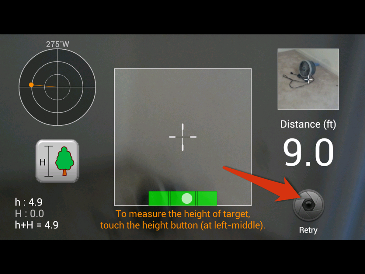
General steps for an AR ruler app
- Install a reputable AR measurement app from Google Play or open your phone manufacturer’s built-in measuring tool.
- Grant camera permission and select feet/inches or metric units.
- Point the camera toward a bright, textured, unobstructed surface.
- Move the phone slowly so the app can detect the floor, wall, or object.
- Place virtual markers at the beginning and end of the item, then read the estimated measurement.
Using Samsung Quick Measure
Some compatible Samsung Galaxy devices support Quick Measure through the camera or AR Zone. Depending on the phone and available depth hardware, it may estimate distance, length, area, three-dimensional dimensions, or a person’s height. Availability differs among Galaxy models and software versions.
Tips for more reliable AR measurements
Use bright, even lighting and avoid glass, mirrors, shiny metal, plain white surfaces, or moving objects. Hold the phone steadily and keep both endpoints visible whenever possible. Measure from a position that faces the object directly rather than from a steep angle.
Repeat the measurement two or three times. If the results vary noticeably, confirm the dimension with a physical tape measure. AR is excellent for checking whether a table is approximately six feet long. It is less suitable for cutting a countertop where being wrong by half an inch can transform a pleasant afternoon into a vocabulary-expanding event.
How Accurate Are Android Distance Measurements?
Accuracy depends on what is being measured and which technology is doing the measuring.
Google Maps point-to-point measurements
The Google Maps measurement tool calculates distance from selected map coordinates. Its usefulness therefore depends largely on how precisely you place each point and whether the visible imagery accurately represents the feature on the ground.
Zoom level matters. A one-pixel placement error represents very little distance when viewing a house but can represent a substantial distance when viewing an entire state.
Live GPS tracking
Consumer phone GPS is designed primarily for navigation, not professional surveying. Under open sky, GPS-enabled smartphones may locate themselves within roughly 16 feet under favorable conditions, while buildings, bridges, trees, atmospheric effects, and receiver quality can reduce accuracy. Government guidance also notes that ordinary smartphone positioning is often suitable for navigation but not for measurements requiring centimeter-level precision.
When tracking a walk or run, small location errors can accumulate. A recorded route may zigzag beside the actual path, adding extra distance. Dense city streets, tunnels, indoor areas, forests, and steep terrain can make the problem worse.
AR camera measurements
AR estimates depend on plane detection, camera quality, available sensors, lighting, movement, and the clarity of an object’s edges. Measurements of a small box may be reasonably close under ideal conditions, while a long room or distant wall may produce a larger error.
Use phone measurements for estimates, shopping decisions, preliminary planning, and casual comparisons. Use professional equipment for construction, engineering, medical, legal, or safety-critical work.
How to Improve Location and Measurement Accuracy
Turn on Location Accuracy
Open Android Settings, tap Location, and look under Location services for Google Location Accuracy. Exact menu names vary by manufacturer and Android version.
When enabled, Android can combine GPS with nearby Wi-Fi access points, cell towers, and device sensors such as the accelerometer, gyroscope, and barometer. This can help the device determine its position more quickly, especially when satellite reception is limited.
Check app permissions
Press and hold the Google Maps or fitness app icon, tap App info, and review its Location permission. Select precise location when the app needs an accurate position. Fitness apps may also require background location access to record a complete route while the screen is off.
Move outdoors and wait for a stable signal
GPS generally performs better with a broad view of the sky. Move away from tall buildings, covered parking areas, dense trees, and metal structures. Give the phone a moment to establish a stable position before beginning a recorded walk or ride.
Calibrate Google Maps
If the blue location dot has a wide accuracy circle or points in the wrong direction, tap it and look for a calibration option. Depending on availability, Maps may use nearby buildings and signs through the camera. You can also calibrate the compass by moving the phone in a figure-eight pattern. Turning off Battery Saver, enabling Wi-Fi, and leaving Airplane Mode off may also help.
Measure more than once
Repeated measurements expose inconsistent results. For map distances, zoom in and replace any poorly positioned points. For AR measurements, restart plane detection and measure from another angle. For exercise tracking, compare the recorded route with a known-distance path.
Common Problems and Quick Fixes
“Measure distance” does not appear
You probably selected a labeled business or place instead of an unlabeled map position. Close the place card, long-press a blank area, and open the dropped pin’s details. Updating Google Maps may also restore missing or relocated menu options.
The measurement follows a straight line instead of the road
That is expected. The Measure distance tool connects the points directly. Use Directions when you need road mileage, or add multiple points manually to approximate a specific path.
The blue dot is in the wrong place
Turn on Location services, enable Google Location Accuracy, allow precise location access, disable Airplane Mode, and move to an area with a clearer view of the sky. Restarting the phone can resolve a temporary location-service problem.
An AR ruler cannot detect the surface
Add light, move the phone slowly, and aim at a surface with visible texture. A patterned rug is easier for an AR system to understand than a glossy white floor. Clean the camera lens as well; your phone cannot map a room accurately through a layer of pocket lint and fingerprints.
The fitness distance looks too long
Open the recorded route and look for jumps, loops, or zigzags. Location errors can add false distance. For future sessions, wait outdoors for a stable GPS signal before starting, keep battery restrictions from shutting down the fitness app, and confirm that precise location is permitted.
Practical Experiences When Measuring Distance on Android
Experience 1: Measuring a park loop before running it
A useful real-world test is planning a run around a neighborhood park. Using only a starting point and an ending point gives the direct distance across the park, which is not very helpful unless your training plan includes sprinting through a pond.
A better approach is to enter Google Maps measurement mode and add points along each bend in the path. The closer those points follow the visible trail, the better the estimate. After tracing the full loop, compare the result with the distance recorded by a fitness app during the actual run.
The two values may not match perfectly. The map measurement is based on manually selected coordinates, while the fitness app collects a sequence of changing GPS positions. A small difference is normal. A large difference usually indicates that the trail was traced too loosely or the live recording contained location jumps.
Experience 2: Checking whether furniture will fit
Imagine finding a discounted bookcase online with dimensions that look reasonable. “Reasonable,” however, is how many furniture-related arguments begin.
An AR ruler can provide a quick estimate of the wall and available floor space. Start by scanning the floor and wall slowly so the app can establish a stable plane. Measure the width in several attempts, keeping the phone directly facing the surface. Then subtract space for baseboards, doors, electrical outlets, and room to maneuver the bookcase into position.
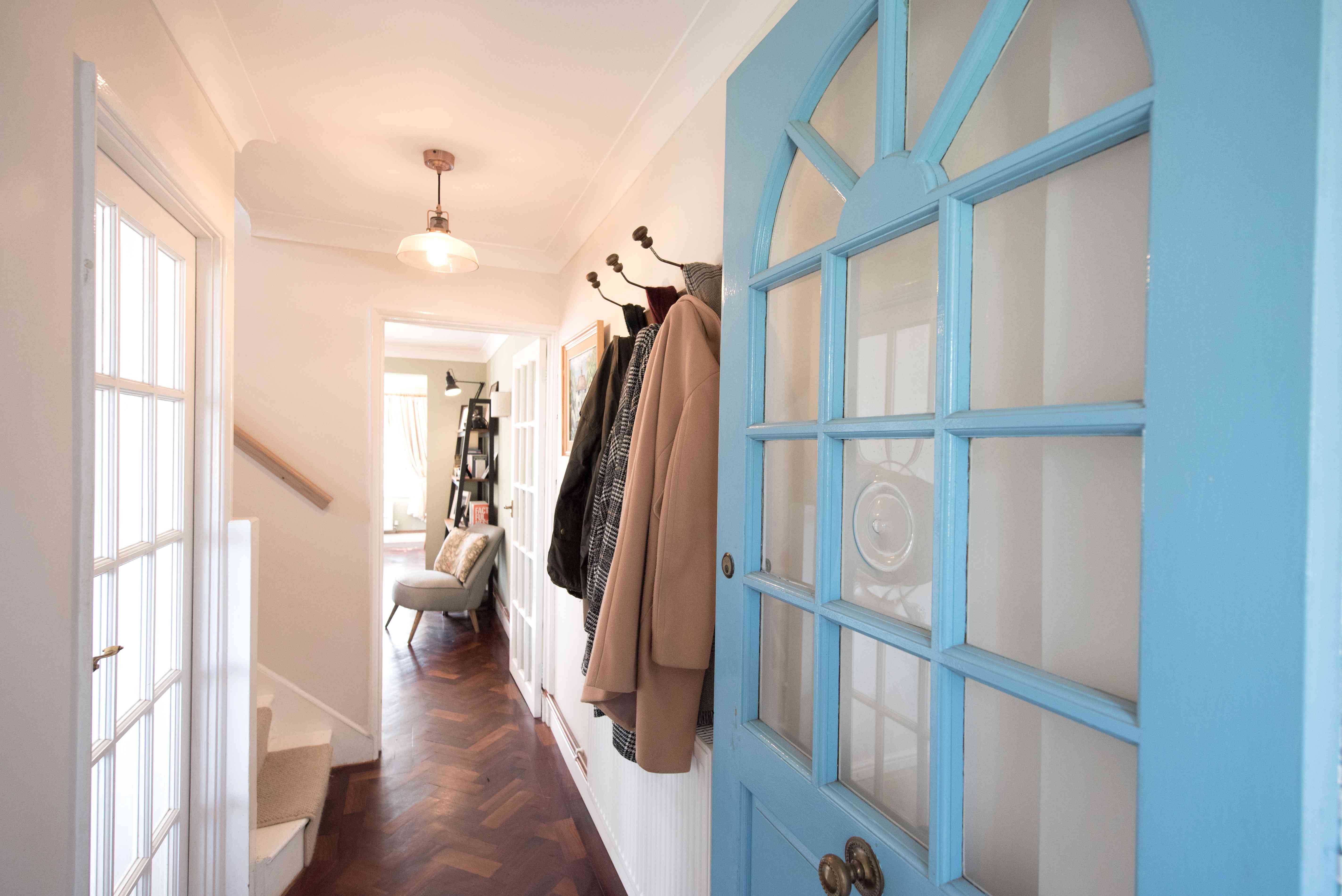
Before purchasing, confirm the result with a tape measure. Also measure the doorway, hallway, stairwell, elevator, and any corner the furniture must pass. A bookcase that fits beautifully against the wall but cannot enter the apartment is technically a very expensive porch decoration.
Experience 3: Estimating the length of a backyard fence
Google Maps satellite view can provide a convenient preliminary estimate for a fence project. Drop a pin at one corner, select Measure distance, and add points at each change in direction. Record the total and then inspect each section on the ground.
The phone measurement is useful for rough budgeting, such as estimating how many fence panels may be required. It should not replace an on-site measurement because satellite imagery may be old, partially hidden by trees, or offset from the true boundary. Sloped terrain also means the surface distance can be longer than the flat map distance.
For an actual installation, use a physical measuring tape, measuring wheel, or professional survey information. The map gives you a planning number; the ground gives you the number that determines whether you must make another trip to the hardware store.
Experience 4: Comparing direct distance with driving distance
Measuring between two destinations often produces two dramatically different answers. A direct map measurement might show that a hotel is only three miles from an event venue. Driving directions may show seven miles because the available route must cross a river at a distant bridge.
This comparison is valuable when choosing hotels, restaurants, schools, or meeting points. Direct distance tells you how geographically close the locations are. Route distance tells you how practical the trip is. For everyday planning, the second number is usually more important.
Experience 5: Tracking a walk through a dense city
Walking-distance tracking is often less consistent among tall buildings. Satellite signals can reflect from glass and concrete, causing the recorded position to bounce from one side of the street to another. The final route may look as if you explored several office lobbies without opening a door.
Starting the workout outdoors, waiting for the location to stabilize, and keeping precise location enabled can improve the result. It also helps to compare the recorded distance with Google Maps walking directions. Neither figure should be treated as laboratory-grade, but together they provide a sensible estimate.
Google Fit and similar tools can calculate distance and create activity maps when appropriate location permissions are enabled. Users can generally control whether location tracking is allowed and whether maps are included with recorded activities.
Conclusion
Learning how to measure distance on Android begins with identifying the kind of distance you need. Google Maps’ Measure distance tool is ideal for direct lines and manually traced paths. Directions provide practical driving, walking, and cycling mileage. Fitness apps record the distance you travel, while AR ruler tools estimate the dimensions of rooms and objects.
For the best results, zoom in before placing map points, add extra points around curves, enable precise location, calibrate the phone when necessary, and repeat important measurements. Most importantly, remember that a smartphone provides a convenient estimatenot a professional land survey, construction instrument, or magical camera-shaped tape measure.